


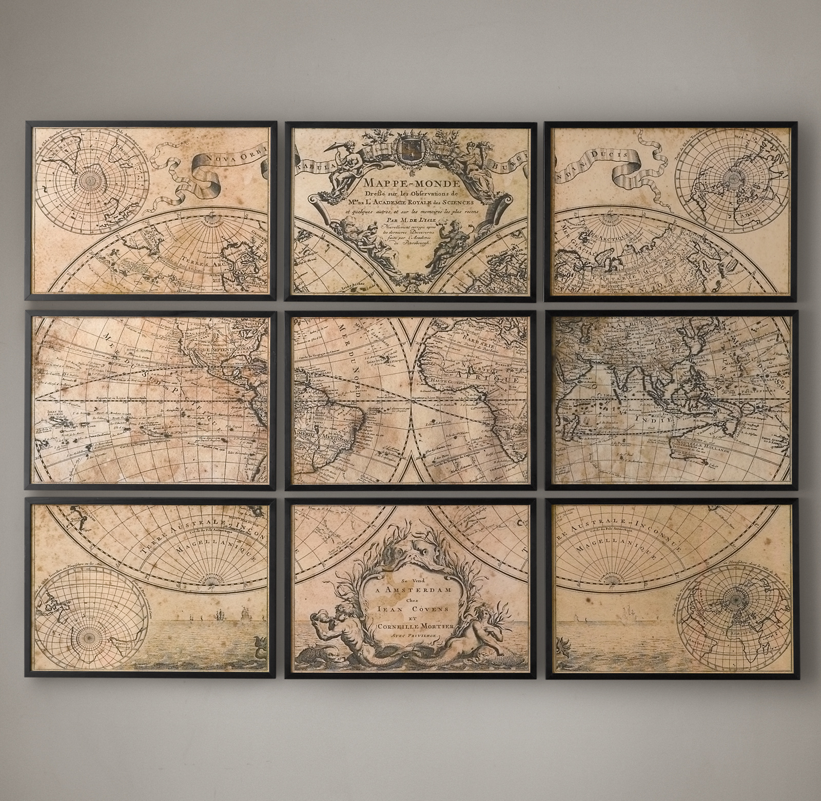
L'Isle's 1720 World Map
We're sorry. This product is no longer available
Please continue browsing.Created by French Royal Geographer Guillaume de L'Isle in 1720, this mappe monde traces the paths of great explorers, including St. Antoine, Mandana and Quir and Dutchman Abel Tasman (for whom Tasmania was named). A revision of L'Isle's groundbreaking 1700 map, it was among the first to show California with a continuous coastline and to accurately depict the tip of South America. Our grand-scale reproduction fills nine framed panels.
Details
- A faithful reproduction of Guillaume de L'Isle's 1720 map of the world, originally published in Amsterdam
- 9 panels include the main map, sub maps and cartouches replete with romantic flourishes, including ships in full sail, a mermaid and merman and allegorical figures representing 4 continents
- Expertly produced giclée print features the subtle mottling and fading of the original vintage paper
- Printed on archival watercolor paper Sepia-toned to create a deep amber hue
- Each panel framed in vintage black wood behind Plexiglas®
Dimensions
- Each panel: 28"W x 20"H
- Overall: 84"W x 60"H